
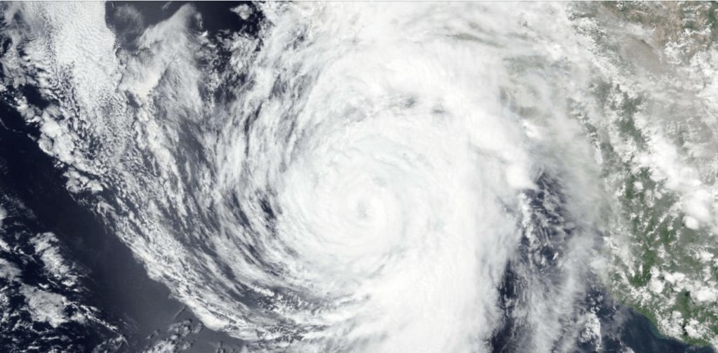
Water water everywhere. That’s Kay’s swan song, with arroyos washing out roads along the entire peninsula. She wasn’t even a strong hurricane – a category 2 in her heaviest moment – but she was grand – huge arms nearly 600 miles across. Her winds ran as high as 72mph in various locations, but her water. The rain. The desperately needed rain came all at once, the ground crusty dry. No way to absorb, but rush and run down the mountain faces and arroyos.

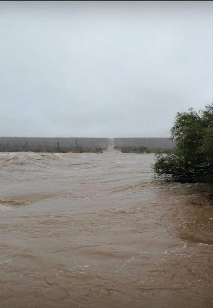
Multiple towns took hard hits. The Mulege river once again breached its banks, flooding everyone and thing in proximity. San Felipe, usually a dry sandy desert, found itself with streets of rivers, more suited to kayaks or canoes.
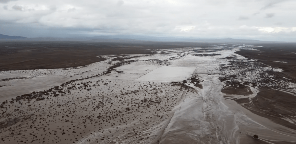
The major effect of Kay was on MEX 1 the transpeninsular highway that transits between Tijuana and Cabo San Lucas. The road cut in so many places that traffic and commerce were actually halted for three days. Today, the 13th of September, most roads have some measure of passage, and the large double tractor trailers could be seen heading south. Below, some photographs, borrowed from various posts and publications, communicate what my words lack.


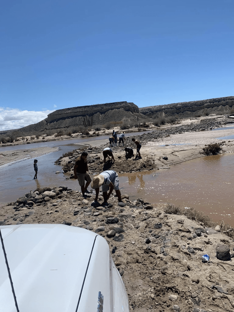
Close to home, or the home I cannot yet reach, the highway between Insurgentes and San Juanico washed out first in Insurgentes, and then the bridge was obliterated over the wash a few miles outside of town.
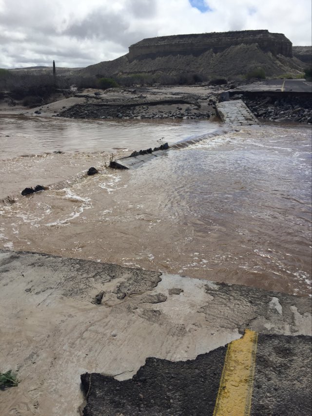

The townspeople came together, and with shovels and arms full of rock and mud, began the process of crafting a crossing. It’s this spirit of ‘can-do’ which continues to fuel my love for Baja.


You must be logged in to post a comment.